


Customize which cookies you want to accept
These cookies are essential for the website to function properly. They enable core functionality such as security, network management, and accessibility. You cannot opt-out of these cookies.
These cookies help us understand how visitors interact with our website by collecting and reporting information anonymously. This helps us improve our website's performance.
These cookies enable enhanced functionality such as remembering your preferences, language settings, and providing personalized features to improve your experience.
These cookies are used to deliver personalized advertisements relevant to you and your interests. They also help measure the effectiveness of advertising campaigns.
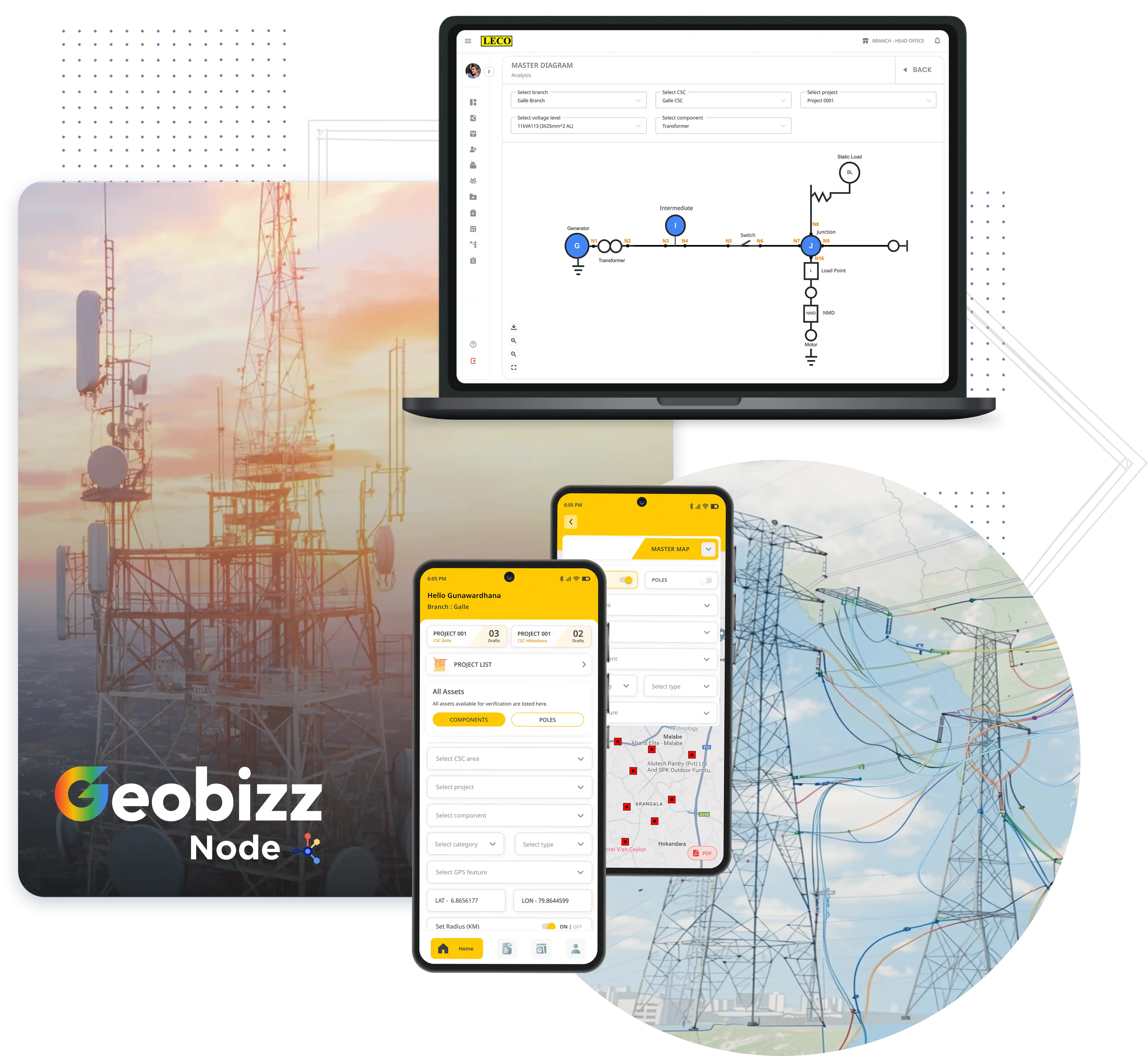
One Platform. Zero Disconnect. Replace Separate CAD & GIS Tools Entirely.
GeoBizz Node (Version 2.0) is an award-winning, battle-tested, cloud-native Unified GIS, Single Line Diagram (SLD) & Real-Time Flow Platform engineered by Celata Tech.
Say goodbye to managing separate CAD drafting software and standalone GIS tools. With GeoBizz Node's intuitive NoCode Builder, draftsmen and engineers can draft, modify, and update master schematic drawings that automatically sync bi-directionally with the real-world master map — complete with live electricity and data flow visualization right on your network lines. Map your physical assets, model active topology, visualize live power and telemetry flow, and establish a single, real-time Single Source of Truth for your entire utility network.
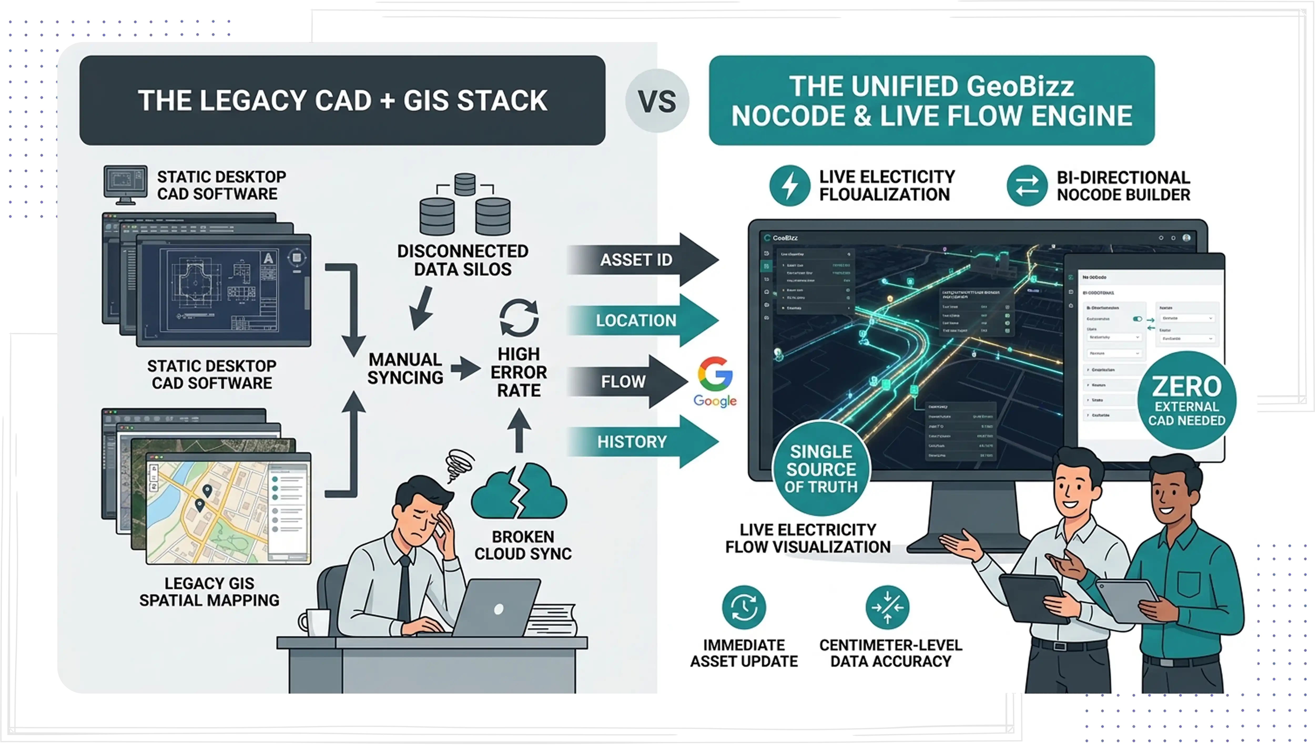
Traditionally, utilities maintain separate drafting software (for single-line diagrams, engineering schematics, and master drawings) and separate GIS software (for spatial asset management). This leads to duplicate data entry, version conflicts, and blind spots regarding active network state.
Every schematic, every asset, and every live reading lives in one system of record — eliminating the duplicate data entry, version conflicts, and blind spots that come from running CAD and GIS as separate tools.
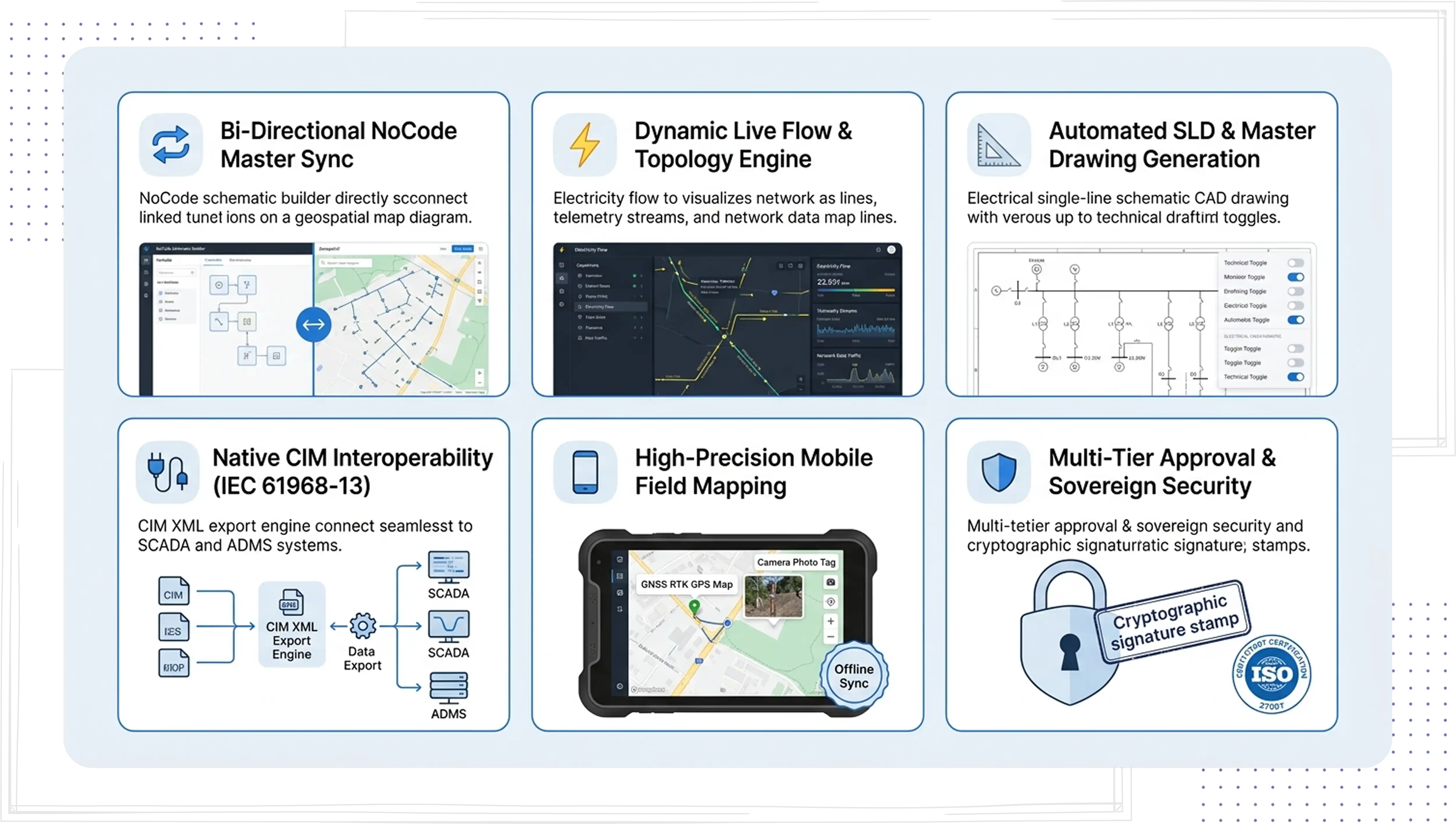
Draft schematics and update master drawings using a NoCode builder. Changes seamlessly reflect across spatial maps and single-line diagrams in real time, eliminating dual-data entry across disconnected software.
Visualize active electricity flow, telemetry streams, and network data traffic overlaid directly onto geospatial map lines. Supports asymmetrical phase modeling (R, Y, B, neutral) for high-precision load-flow calculations and instant fault impact tracing.
Convert geospatial network data into accurate Single Line Diagrams (SLDs) instantly. Includes built-in version control to toggle seamlessly between "As-Built," "Current," and "Planned" states.
Built-in CIM RDF Export Engine generates standard-compliant IEC 61968-13 CIM XML files natively. Feed pristine network topology directly into SCADA, ADMS, and smart grid systems without third-party translation scripts.
Equip field teams with a high-accuracy GNSS/RTK integrated mobile app. Capture geotagged photos, map conductors, and perform offline data entry with intelligent background server synchronization.
Manage drafting and engineering sign-offs via Role-Based Access Control (RBAC) and cryptographic signatures. Fully compliant with Sri Lanka PDPA No. 9 of 2022 and ISO 27001 standards.
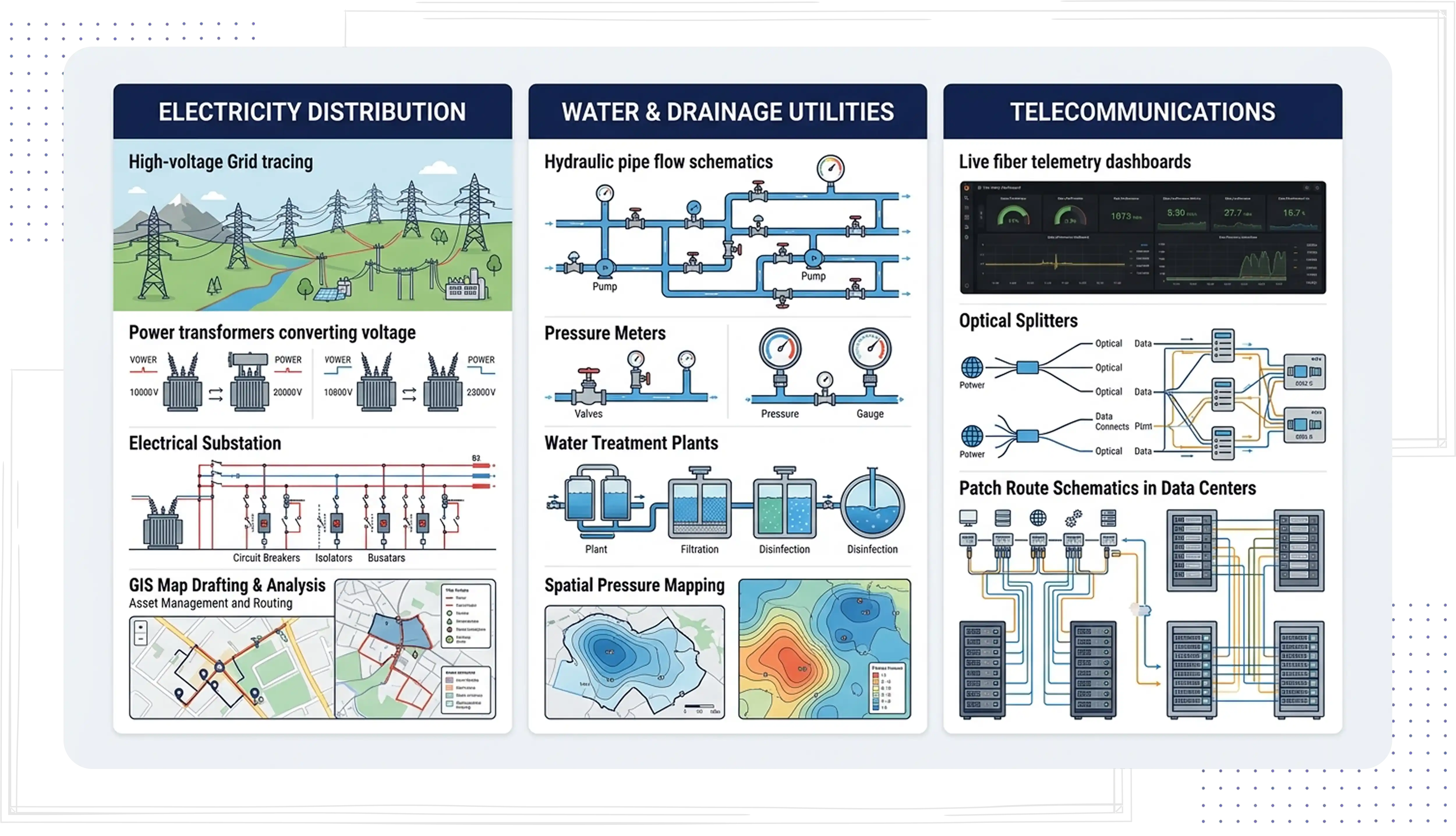
Live Power Flow & Grid Tracing — View real-time electricity flow animations across high-voltage feeders down to LV lines and consumer meters. Track directional load changes, backfeed states, and phase balance dynamically on the master map.
NoCode Feeder & Substation Drafting — Draftsmen can update feeder lines and substation single-line diagrams, automatically propagating connectivity, live flow indicators, and phase data onto the spatial master grid.
Hydraulic Flow & Pressure Mapping — Connect treatment plants, main conduits, booster stations, valves, and water meters into a unified hydraulic model displaying active fluid flow directions and localized pressure drops.
Schematic-to-Spatial Pressure Monitoring — Update network drawings with new valves or bypass conduits using NoCode tools and immediately view updated flow and pressure impact zones on the GIS map.
Live Fiber & Data Flow Telemetry — Monitor fiber capacity, optical signal paths, and real-time network data flow across exchange nodes, splitters, and subscriber drop cables on the map.
Unified Route & Patch Schematics — Draw fiber patch connections and distribution loops schematic-style, automatically updating physical fiber routing and active data paths across geographic maps.
Live Gas Pressure & Directional Flow — Track volumetric gas flow rates, pressure fluctuations, and pipeline operational status visually across city gate stations and distribution networks.
Bi-Directional Safety Isolation — Draw proposed valve shut-off diagrams and immediately simulate isolation zones and flow stoppage across the master geospatial database for emergency planning.
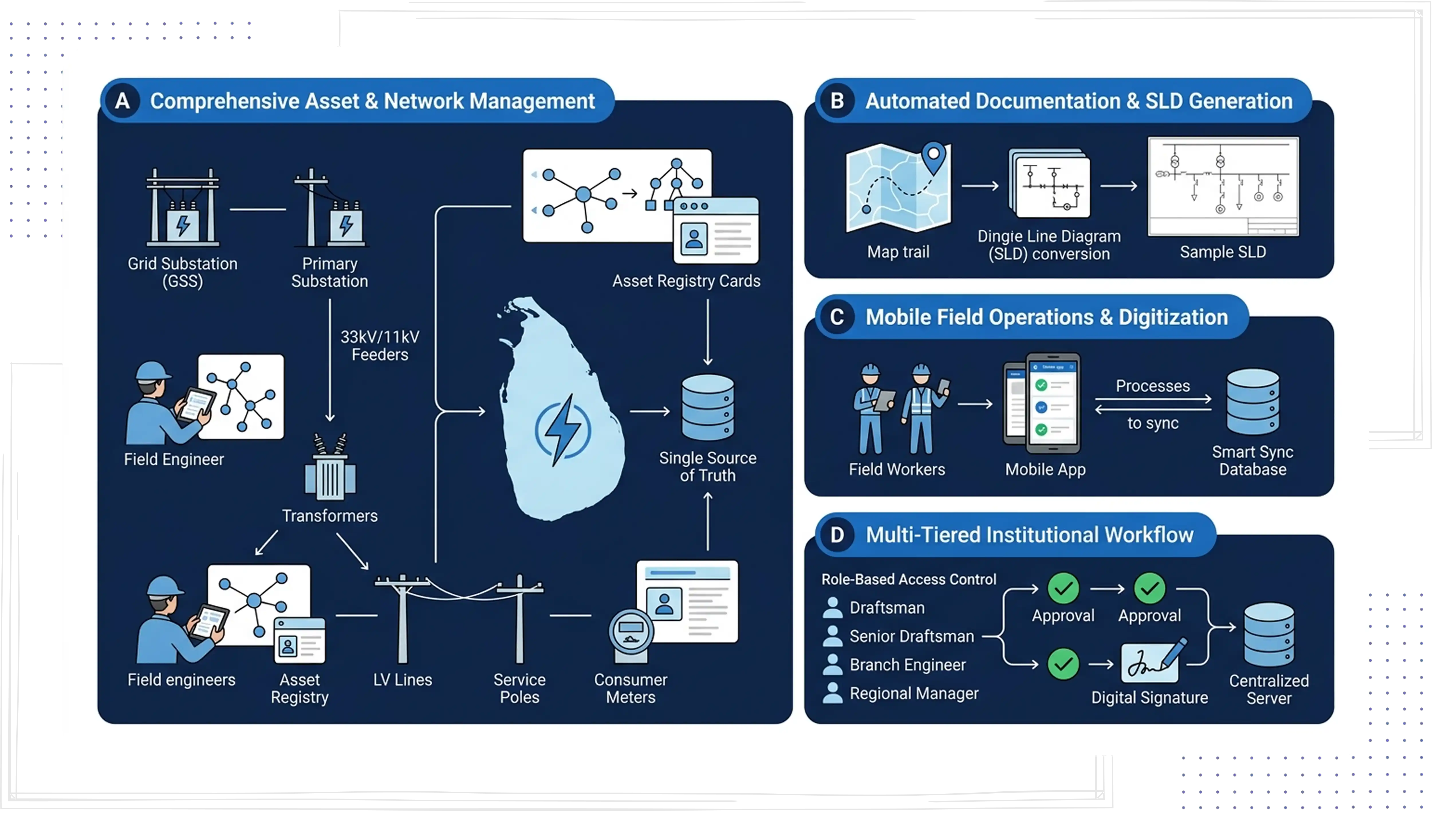
Successfully deployed for major distribution utilities, including the Lanka Electricity Company (LECO).
Winner of the prestigious National Best Quality Software Award.
Replaces separate CAD, GIS, and visualization tools with a single turnkey platform, shortening time-to-value from years to months.
Book a live walkthrough of GeoBizz Node and see your own network mapped, drafted and monitored on a single platform.